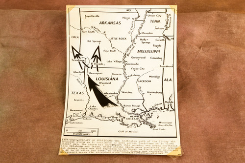


Original 1947 AP Wire Photo map dated September 20 showing the path of the 11-day-old tropical storm as it moved across Louisiana and weakened. The caption notes that the storm struck Shreveport that morning before moving northwest into Oklahoma and Texas, with winds reduced to about 40 to 50 mph. Additional strong winds were predicted for Arkansas, though major damage there was not expected. The caption is printed directly on the photograph. Please note tape on the corners and age-related wear. Measures approximately 6¼ x 9¼ inches. From the archive of a Pittsburgh-area newspaper.